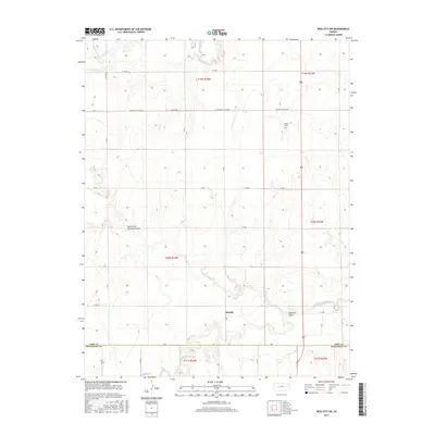
2015 Map of Ness City SW
USGS Topo · Published 2015About this map
The Harold settlement stands near the center of this rural Kansas landscape, situated just north of where the Pawnee River meanders across the southern plains. This area of Ness County is defined by its drainage systems, with the S Fork Walnut Cr cutting through the northwestern corner and the seasonally named Guzzlers Gulch and South Fork Guzzlers Gulch shaping the local topography. The map reveals a strictly organized grid of county roads, such as Co RD 528 and Y RD, which segment the terrain into the sections of the Public Land Survey System. Genealogists may find particular interest in the Kunze Cem, a small landmark located along the eastern edge of the quadrangle. The boundary between Ness Co and Hodgeman Co is clearly delineated along the southern margin, marking the transition between these two western Kansas counties.
Find a feature on this map
35 named features on this map. Tap any name to fly to it.
Don’t see what you’re looking for? This feature index may not catch every label — zoom into the map to look around manually.
Map Details
Editions of this 2015 Ness City SW Map
This is the sole edition of this map. No revisions or reprints were ever made.
Other maps of this area

1892 · Ness
USGS Topo · 1:125,000

1894 · Ness
USGS Topo · 1:125,000

1955 · Great Bend
USGS Topo · 1:250,000

1955 · Scott City
USGS Topo · 1:250,000

1957 · Great Bend
USGS Topo · 1:250,000

1958 · Great Bend
USGS Topo · 1:250,000

1958 · Scott City
USGS Topo · 1:250,000

1966 · Ness City
USGS Topo · 1:24,000

1966 · Ness City NE
USGS Topo · 1:24,000

1966 · Laird
USGS Topo · 1:24,000