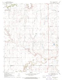
1970 Map of Ness City SW
USGS Topo · Published 1972About this map
Walnut Creek and the South Fork Walnut Creek carve through the northern landscape of Franklin Township, while the Pawnee River defines the southern reach across the Ness and Hodgeman county line. This 1970 survey captures a region defined by its energy and agricultural extraction, notably centered on the Petersilie Oil Field. The map records sparse but significant markers of early settlement, such as Harold and the small township of Valley, alongside the Kunze Cem. The presence of a Gaging Station and a Quarry indicates an active management of natural resources during this era. Land is subdivided by section lines, with drainage features like Quizzlers Gulch showing the complex topography that channels water toward the major creek systems.
Find a feature on this map
16 named features on this map. Tap any name to fly to it.
Don’t see what you’re looking for? This feature index may not catch every label — zoom into the map to look around manually.
Map Details
Editions of this 1970 Ness City SW Map
This is the sole edition of this map. No revisions or reprints were ever made.
Other maps of this area

1892 · Ness
USGS Topo · 1:125,000

1894 · Ness
USGS Topo · 1:125,000

1955 · Great Bend
USGS Topo · 1:250,000

1955 · Scott City
USGS Topo · 1:250,000

1957 · Great Bend
USGS Topo · 1:250,000

1958 · Great Bend
USGS Topo · 1:250,000

1958 · Scott City
USGS Topo · 1:250,000

1966 · Ness City
USGS Topo · 1:24,000

1966 · Ness City NE
USGS Topo · 1:24,000

1966 · Laird
USGS Topo · 1:24,000