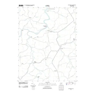
2011 Map of Nestorville
USGS Topo · Published 2011About this map
Tygart Lake and the winding course of the Tygart River define the northern reaches of this Barbour County landscape. Historical memory is preserved through several locations noted as no longer active, including Cove Run Station, New Moatsville, and Dantown. Local commerce and community life center on Moatsville, where the Moatsville Post Office is situated near the confluence of Teter Creek and the river. Farther south, the namesake settlement of Nestorville anchors a network of rural routes that once supported a localized economy of mills and furnaces. The map identifies Vannoys Mill along Sand Run and the site of Valley Furnace in the east, reflecting the area's industrial heritage. Genealogists will find value in the placement of Fairview Cemetery, Welch Cemetery, and the Croston School, which speak to the rural social structures of the early 21st century.
Find a feature on this map
80 named features on this map. Tap any name to fly to it.
Don’t see what you’re looking for? This feature index may not catch every label — zoom into the map to look around manually.
Map Details
Editions of this 2011 Nestorville Map
This is the sole edition of this map. No revisions or reprints were ever made.
Other maps of this area

1886 · St. George
USGS Topo · 1:125,000

1891 · St. George
USGS Topo · 1:125,000

1902 · Fairmont
USGS Topo · 1:62,500

1904 · Philippi
USGS Topo · 1:62,500

1907 · Thornton
USGS Topo · 1:62,500

1907 · Belington
USGS Topo · 1:62,500

1923 · Fairmont
USGS Topo · 1:62,500

1925 · Philippi
USGS Topo · 1:62,500

1926 · Fairmont
USGS Topo · 1:62,500

1926 · Thornton
USGS Topo · 1:62,500