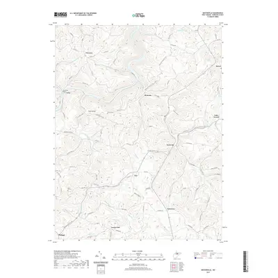
2019 Map of Nestorville
USGS Topo · Published 2019About this map
Vannoys Mill and the crossing at Rock Ford anchor the southern reaches of this Barbour County landscape, where winding watercourses like Teter Cr and Laurel Creek define the settlement patterns. The topography is marked by significant ridges and hollows, including Chestnut Ridge and Moatsville Hollow, which historically dictated the placement of small communities such as Clemtown, Tacy, and Kalamazoo. Local heritage is preserved in sites like the Arden Truss Bridge and several upland burial grounds, including Fairview Cem and Olive Hill Cem. The presence of Valley Furnace in the east points to the region's industrial past, while contemporary paths like the American Discovery Trail now weave through the established network of county routes and hillsides, connecting these rural hamlets across the high ground of Sunshine Ridge Rd and Miller Hill.
Find a feature on this map
93 named features on this map. Tap any name to fly to it.
Don’t see what you’re looking for? This feature index may not catch every label — zoom into the map to look around manually.
Map Details
Editions of this 2019 Nestorville Map
This is the sole edition of this map. No revisions or reprints were ever made.
Other maps of this area

1886 · St. George
USGS Topo · 1:125,000

1891 · St. George
USGS Topo · 1:125,000

1902 · Fairmont
USGS Topo · 1:62,500

1904 · Philippi
USGS Topo · 1:62,500

1907 · Thornton
USGS Topo · 1:62,500

1907 · Belington
USGS Topo · 1:62,500

1923 · Fairmont
USGS Topo · 1:62,500

1925 · Philippi
USGS Topo · 1:62,500

1926 · Fairmont
USGS Topo · 1:62,500

1926 · Thornton
USGS Topo · 1:62,500