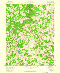
1958 Map of Nestorville
USGS Topo · Published 1960About this map
The Tygart River Reservoir winds through the hills of Barbour County in the late 1950s, defining a landscape of deep valleys and small highland communities. Local industry and traditional livelihoods are visible in the proximity of Strip Mines near Moatsville and the Vannoy Mill on Glady Creek. The map documents a dense network of rural infrastructure, including numerous family and community landmarks like Mariahs Ch and Hoffman Sch.
Find a feature on this map
64 named features on this map. Tap any name to fly to it.
Don’t see what you’re looking for? This feature index may not catch every label — zoom into the map to look around manually.
Map Details
Editions of this 1958 Nestorville Map
2 editions found
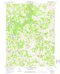
Other maps of this area

1886 · St. George
USGS Topo · 1:125,000

1891 · St. George
USGS Topo · 1:125,000

1902 · Fairmont
USGS Topo · 1:62,500

1904 · Philippi
USGS Topo · 1:62,500

1907 · Thornton
USGS Topo · 1:62,500

1907 · Belington
USGS Topo · 1:62,500

1923 · Fairmont
USGS Topo · 1:62,500

1925 · Philippi
USGS Topo · 1:62,500

1926 · Fairmont
USGS Topo · 1:62,500

1926 · Thornton
USGS Topo · 1:62,500