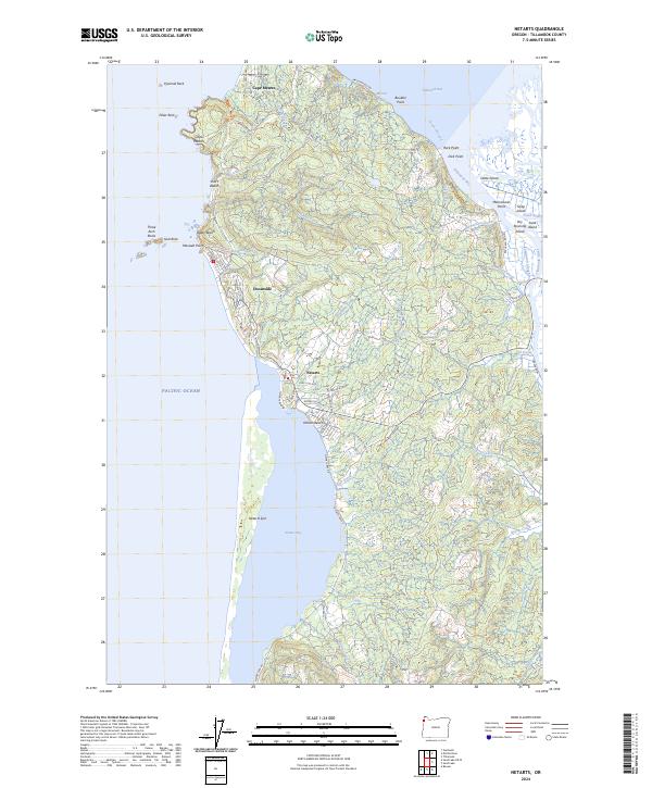
2024 Map of Netarts
USGS Topo · Published 2024About this map
Netarts Bay defines the central geography of this coastal landscape, sheltered by the long, narrow Netarts Spit that separates it from the Pacific Ocean. The village of Netarts sits on the bay's northeastern shore, connected to nearby Wilson Beach and Oceanside via Netarts Bay Rd and Netarts Blvd W. Further north, the prominent headland of Cape Meares serves as a major landmark, punctuated by Pillar Rock and Pyramid Rock just offshore. These rugged formations are protected as part of the Cape Meares National Wildlife Refuge, reflecting a shoreline where conservation boundaries meet recreational beaches like Agate Beach and Short Beach. To the east, the map reveals the complex tidal environments of Tillamook Bay, where the Trask River and Tillamook River meet a network of islands including Snag Island and Dry Stocking Island, illustrating the intersection of freshwater drainage and the Pacific's influence.
Find a feature on this map
90 named features on this map. Tap any name to fly to it.
Don’t see what you’re looking for? This feature index may not catch every label — zoom into the map to look around manually.
Map Details
Editions of this 2024 Netarts Map
This is the sole edition of this map. No revisions or reprints were ever made.
Other maps of this area

1937 · Nehalem
USGS Topo · 1:62,500

1942 · Tillamook
USGS Topo · 1:62,500

1943 · Nehalem
USGS Topo · 1:62,500

1948 · Vancouver
USGS Topo · 1:250,000

1950 · Vancouver
USGS Topo · 1:250,000

1950 · Vancouver
USGS Topo · 1:250,000

1955 · Nehalem
USGS Topo · 1:62,500

1955 · Tillamook
USGS Topo · 1:62,500

1958 · Vancouver
USGS Topo · 1:250,000

1964 · Vancouver
USGS Topo · 1:250,000