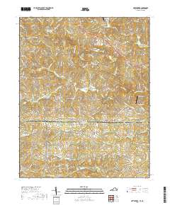
2019 Map of Nettleridge
USGS Topo · Published 2019About this map
The Virginia North Carolina state line bisects this landscape, separating the rugged topography of Patrick Co in the north from Stokes Co in the south. The upper reaches of the South Mayo River drain the Piedmont terrain, while historical sites like Gilbert Mill and Nettle Ridge anchor the rural settlement pattern. This 2019 survey documents a region defined by its dispersed small-scale aviation and religious sites, ranging from Landis Airport to several family and community burial grounds.
Find a feature on this map
115 named features on this map. Tap any name to fly to it.
Don’t see what you’re looking for? This feature index may not catch every label — zoom into the map to look around manually.
Map Details
Editions of this 2019 Nettleridge Map
This is the sole edition of this map. No revisions or reprints were ever made.
Other maps of this area

1926 · Critz
USGS Topo · 1:48,000

1928 · Stuart
USGS Topo · 1:48,000

1928 · Critz
USGS Topo · 1:62,500

1931 · Stuart
USGS Topo · 1:62,500

1953 · Winston-Salem
USGS Topo · 1:250,000

1955 · Winston-Salem
USGS Topo · 1:250,000

1962 · Winston-Salem
USGS Topo · 1:250,000

1964 · Hanging Rock
USGS Topo · 1:24,000

1967 · Patrick Springs
USGS Topo · 1:24,000
1967 · Spencer
USGS Topo · 1:24,000