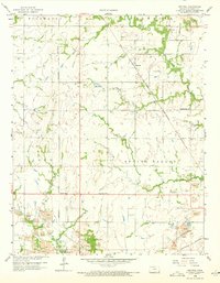
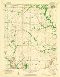
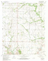
1958 Map of Neutral
USGS Topo · Published 1973About this map
Extensive extractive operations dominate the southern landscape of this Cherokee County survey, where the heavy concentration of Tailings, Mine shafts, and Mines reveals the intense lead and zinc mining of the era. Near the Oklahoma border, the settlement of Treece and the smaller Cravensville sit amidst this industrial terrain, while the prominent Blue Mound rises above the surrounding plains. The St Louis San Francisco railroad cuts diagonally across the quadrangle, serving as a primary artery through the townships of Spring Valley and Lyon.
Find a feature on this map
25 named features on this map. Tap any name to fly to it.
Don’t see what you’re looking for? This feature index may not catch every label — zoom into the map to look around manually.
Map Details
Editions of this 1958 Neutral Map
3 editions found
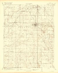
Other maps of this area

1886 · Joplin
USGS Topo · 1:125,000

1894 · Joplin
USGS Topo · 1:125,000

1907 · Wyandotte
USGS Topo · 1:125,000

1909 · Wyandotte
USGS Topo · 1:125,000
1918 · Columbus
USGS Topo · 1:62,500

1947 · Joplin
USGS Topo · 1:250,000

1949 · Joplin
USGS Topo · 1:250,000

1954 · Tulsa
USGS Topo · 1:250,000

1954 · Joplin
USGS Topo · 1:250,000

1958 · Joplin
USGS Topo · 1:250,000