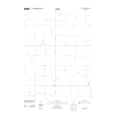
2013 Map of Nevinville
USGS Topo · Published 2013About this map
Nevinville and the surrounding rural landscape are defined by a classic Midwestern grid of section roads and the winding path of the Middle Nodaway River. This 2013 survey of the Adair County borderlands documents small agricultural hubs and historical neighborhood markers like Fisk, Avondale, and Gilead. The terrain is drained by several watercourses including Shanghai Cr and Kosar Br, which cut across the high ground between the farmsteads. The infrastructure is characterized by a dense network of local roads such as Fontanelle Rd and Adair-Adams St, reflecting the persistent importance of land access in this farming region. Small clusters of structures at Williamson and the named crossroads show the long-term settlement patterns of southwest Iowa, providing valuable geographic context for genealogists tracing families in these townships.
Find a feature on this map
40 named features on this map. Tap any name to fly to it.
Don’t see what you’re looking for? This feature index may not catch every label — zoom into the map to look around manually.
Map Details
Editions of this 2013 Nevinville Map
This is the sole edition of this map. No revisions or reprints were ever made.
Other maps of this area

1954 · Greenfield
USGS Topo · 1:62,500

1954 · Omaha
USGS Topo · 1:250,000

1957 · Omaha
USGS Topo · 1:250,000

1958 · Omaha
USGS Topo · 1:250,000

1971 · Fontanelle
USGS Topo · 1:24,000

1971 · Fontanelle SW
USGS Topo · 1:24,000

1980 · Nevinville
USGS Topo · 1:24,000

1980 · Corning North
USGS Topo · 1:24,000

1980 · Bridgewater
USGS Topo · 1:24,000
1980 · Prescott
USGS Topo · 1:24,000