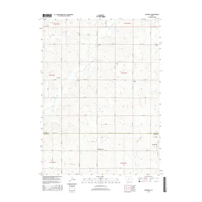
2015 Map of Nevinville
USGS Topo · Published 2015About this map
Nevinville and the surrounding rural townships of Adair and Adams counties are defined by a network of sectional roads and small cemeteries that reflect generations of Iowa farming history. The Middle Nodaway River winds through the northwest, while smaller waterways like Shanghai Cr and Kosar Br drain the rolling agricultural landscape. Small crossroads settlements like Fisk and Williamson serve as focal points for a community structured around the land.
Find a feature on this map
35 named features on this map. Tap any name to fly to it.
Don’t see what you’re looking for? This feature index may not catch every label — zoom into the map to look around manually.
Map Details
Editions of this 2015 Nevinville Map
This is the sole edition of this map. No revisions or reprints were ever made.
Other maps of this area

1954 · Greenfield
USGS Topo · 1:62,500

1954 · Omaha
USGS Topo · 1:250,000

1957 · Omaha
USGS Topo · 1:250,000

1958 · Omaha
USGS Topo · 1:250,000

1971 · Fontanelle
USGS Topo · 1:24,000

1971 · Fontanelle SW
USGS Topo · 1:24,000

1980 · Nevinville
USGS Topo · 1:24,000

1980 · Corning North
USGS Topo · 1:24,000

1980 · Bridgewater
USGS Topo · 1:24,000
1980 · Prescott
USGS Topo · 1:24,000