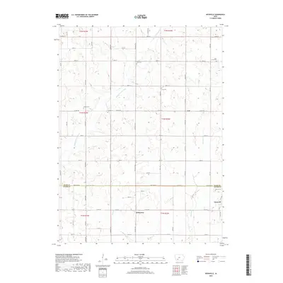
2018 Map of Nevinville
USGS Topo · Published 2018About this map
The Middle Nodaway River winds through this rural landscape on the border of Adair and Adams Counties, defining the drainage of a fertile agricultural region. Small rural centers and historically significant sites like Nevinville and Fisk anchor the area's social geography. This modern survey reflects the enduring grid of the Public Land Survey System, while highlighting numerous burial sites that serve as vital touchstones for family historians. These include the Mormon Cem and Rose Hill Cem, which stand as landmarks of the early pioneers and later generations who settled these plains. The terrain is further etched by smaller watercourses such as Shanghai Cr and Kosar Br, which drain the uplands into the Nodaway basin. This documentation preserves the location of scattered settlements like Williamson and rural burying grounds like Union Cem and Pleasant Grove Cem amidst the modern road network.
Find a feature on this map
52 named features on this map. Tap any name to fly to it.
Don’t see what you’re looking for? This feature index may not catch every label — zoom into the map to look around manually.
Map Details
Editions of this 2018 Nevinville Map
This is the sole edition of this map. No revisions or reprints were ever made.
Other maps of this area

1954 · Greenfield
USGS Topo · 1:62,500

1954 · Omaha
USGS Topo · 1:250,000

1957 · Omaha
USGS Topo · 1:250,000

1958 · Omaha
USGS Topo · 1:250,000

1971 · Fontanelle
USGS Topo · 1:24,000

1971 · Fontanelle SW
USGS Topo · 1:24,000

1980 · Nevinville
USGS Topo · 1:24,000

1980 · Corning North
USGS Topo · 1:24,000

1980 · Bridgewater
USGS Topo · 1:24,000
1980 · Prescott
USGS Topo · 1:24,000