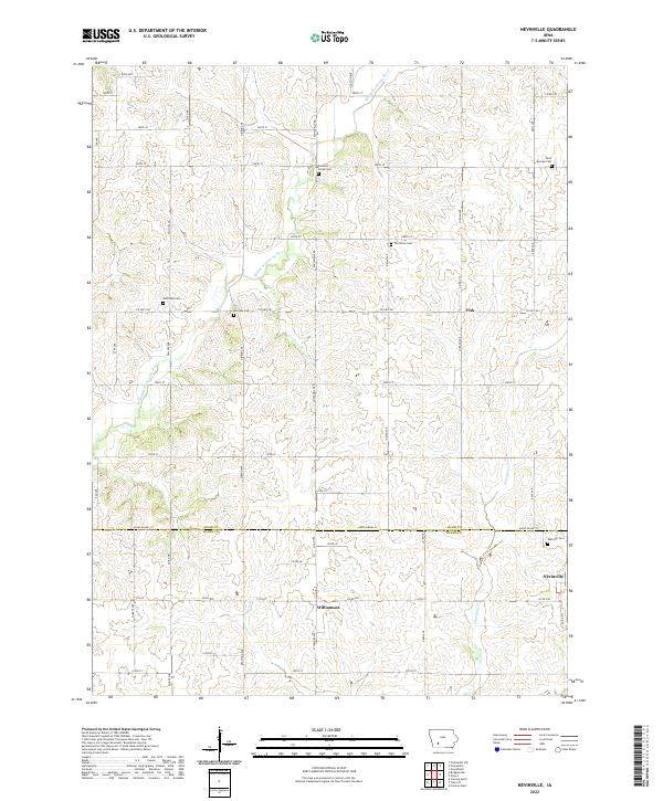
2022 Map of Nevinville
USGS Topo · Published 2022About this map
Middle Nodaway River meanders across this rural section of the Iowa plains, dividing the landscape near the small settlements of Nevinville and Williamson. The terrain is defined by a grid of agricultural section lines and county roads, reflecting the late 19th-century land surveys that shaped the Midwest. Local history is deeply etched into the land through a series of scattered burial grounds, including the Mormon Cem and Rose Hill Cem, which suggest the paths of early pioneers and established farmstead communities.
Find a feature on this map
53 named features on this map. Tap any name to fly to it.
Don’t see what you’re looking for? This feature index may not catch every label — zoom into the map to look around manually.
Map Details
Editions of this 2022 Nevinville Map
This is the sole edition of this map. No revisions or reprints were ever made.
Other maps of this area

1954 · Greenfield
USGS Topo · 1:62,500

1954 · Omaha
USGS Topo · 1:250,000

1957 · Omaha
USGS Topo · 1:250,000

1958 · Omaha
USGS Topo · 1:250,000

1971 · Fontanelle
USGS Topo · 1:24,000

1971 · Fontanelle SW
USGS Topo · 1:24,000

1980 · Nevinville
USGS Topo · 1:24,000

1980 · Corning North
USGS Topo · 1:24,000

1980 · Bridgewater
USGS Topo · 1:24,000
1980 · Prescott
USGS Topo · 1:24,000