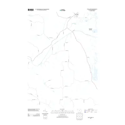
2013 Map of New Albin
USGS Topo · Published 2013About this map
New Albin serves as the northern gateway to Iowa, situated where the bluff-lined valley meets the expansive wetlands of the Mississippi River floodplain. This 2013 survey reveals a landscape defined by water and drainage, with the Upper Iowa River meandering through the center of the map before its confluence with the larger river system. The town's grid is anchored by Main St and Ross Ave, while its eastern edge is bounded by the New Albin Big Lake Public Hunting Area.
Find a feature on this map
43 named features on this map. Tap any name to fly to it.
Don’t see what you’re looking for? This feature index may not catch every label — zoom into the map to look around manually.
Map Details
Editions of this 2013 New Albin Map
This is the sole edition of this map. No revisions or reprints were ever made.
Other maps of this area

1903 · Waukon
USGS Topo · 1:125,000

1926 · Stoddard
USGS Topo · 1:62,500

1929 · Ferryville
USGS Topo · 1:62,500

1932 · Ferryville
USGS Topo · 1:62,500

1956 · Brownsville
USGS Topo · 1:62,500

1958 · La Crosse
USGS Topo · 1:250,000

1961 · La Crosse
USGS Topo · 1:250,000

1965 · La Crosse
USGS Topo · 1:250,000
1965 · Stoddard
USGS Topo · 1:62,500

1966 · Ferryville
USGS Topo · 1:62,500