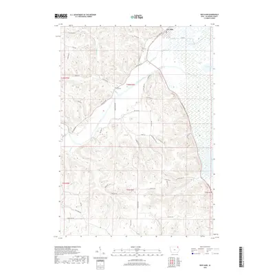
2018 Map of New Albin
USGS Topo · Published 2018About this map
New Albin stands at the northern edge of this Iowa landscape, where the town's grid meets the expansive wetlands of the Mississippi River floodplain. The northeastern quadrant is dominated by a complex network of backwaters and marshes, including Pool Slough, Wood Slough, and Duck Lake, illustrating the shifting aquatic geography of the Upper Mississippi River valley. Moving inland, the terrain rises sharply into the bluffs, carved by the winding Upper Iowa River and its smaller tributaries like Irish Hollow Creek. These deep valleys and high ridges dictate the local road network, with routes like Iowa River Dr following the valley floor. Genealogists will find the locations of Saint Peters Cemetery and Holy Cross Cemetery, which are established on the higher ground overlooking the river systems. The map reflects a rural landscape defined by its proximity to both the river economy and the agricultural uplands.
Find a feature on this map
49 named features on this map. Tap any name to fly to it.
Don’t see what you’re looking for? This feature index may not catch every label — zoom into the map to look around manually.
Map Details
Editions of this 2018 New Albin Map
This is the sole edition of this map. No revisions or reprints were ever made.
Other maps of this area

1903 · Waukon
USGS Topo · 1:125,000

1926 · Stoddard
USGS Topo · 1:62,500

1929 · Ferryville
USGS Topo · 1:62,500

1932 · Ferryville
USGS Topo · 1:62,500

1956 · Brownsville
USGS Topo · 1:62,500

1958 · La Crosse
USGS Topo · 1:250,000

1961 · La Crosse
USGS Topo · 1:250,000

1965 · La Crosse
USGS Topo · 1:250,000
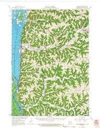
1965 · Stoddard
USGS Topo · 1:62,500

1966 · Ferryville
USGS Topo · 1:62,500