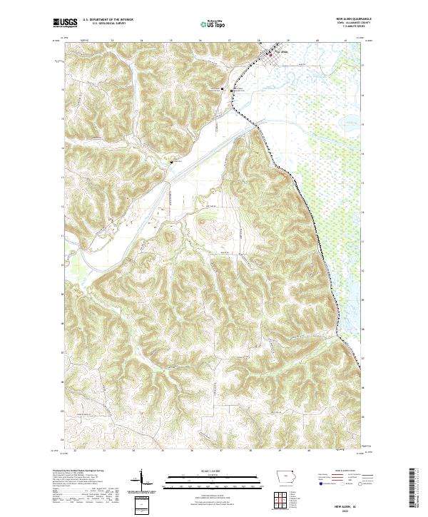
2022 Map of New Albin
USGS Topo · Published 2022About this map
New Albin occupies the northeastern corner of this landscape, situated near the winding course of the Upper Iowa River before it reaches the Mississippi River floodplain. The area is defined by a complex network of wetlands and backwaters, including Pool Slough, Wood Slough, and Duck Lake, which contrast with the deeply dissected uplands to the west. These higher elevations are carved by drainages such as Irish Hollow Cr and Clark Cr, with several ridge-top roads like Pool Hill Dr and Moore Hill Rd navigating the height of land.
Find a feature on this map
49 named features on this map. Tap any name to fly to it.
Don’t see what you’re looking for? This feature index may not catch every label — zoom into the map to look around manually.
Map Details
Editions of this 2022 New Albin Map
This is the sole edition of this map. No revisions or reprints were ever made.
Other maps of this area

1903 · Waukon
USGS Topo · 1:125,000

1926 · Stoddard
USGS Topo · 1:62,500

1929 · Ferryville
USGS Topo · 1:62,500

1932 · Ferryville
USGS Topo · 1:62,500

1956 · Brownsville
USGS Topo · 1:62,500

1958 · La Crosse
USGS Topo · 1:250,000

1961 · La Crosse
USGS Topo · 1:250,000

1965 · La Crosse
USGS Topo · 1:250,000
1965 · Stoddard
USGS Topo · 1:62,500

1966 · Ferryville
USGS Topo · 1:62,500