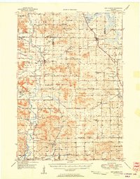
1951 Map of New Auburn
USGS Topo · Published 1951About this map
Sand Creek and New Auburn anchor this mid-century survey of the rural landscape where Barron, Dunn, and Chippewa counties meet. The area is defined by a dense network of one-room schoolhouses and country churches, reflecting a decentralized farming society before later school consolidations. From the Washington Sch in the north to the Loew Sch in the south, these institutions appear every few miles, often alongside family-named landmarks like Fox Settlement Sch.
Find a feature on this map
67 named features on this map. Tap any name to fly to it.
Don’t see what you’re looking for? This feature index may not catch every label — zoom into the map to look around manually.
Map Details
Editions of this 1951 New Auburn Map
This is the sole edition of this map. No revisions or reprints were ever made.
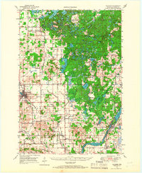
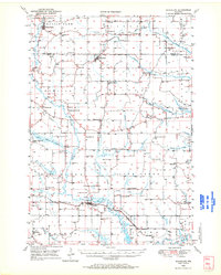
Other maps of this area

1934 · Elk Mound
USGS Topo · 1:62,500

1934 · Chippewa Falls
USGS Topo · 1:62,500

1936 · Chippewa Falls
USGS Topo · 1:62,500

1936 · Elk Mound
USGS Topo · 1:62,500

1940 · Menomonie
USGS Topo · 1:62,500

1942 · Menomonie
USGS Topo · 1:62,500

1948 · Weyerhauser
USGS Topo · 1:48,000
1949 · Bloomer
USGS Topo · 1:62,500

1949 · New Auburn
USGS Topo · 1:62,500
1949 · Ridgeland
USGS Topo · 1:62,500