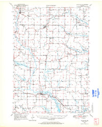
1949 Map of Ridgeland
USGS Topo · Published 1970About this map
Prairie Farm and Ridgeland anchor this northern Wisconsin landscape as it appeared in the late 1940s, situated along a dense network of tributaries feeding the Hay River. The area is defined by a high concentration of rural institutional life, evidenced by dozens of named country schools like Happy Valley Sch and Washburn Farm Sch, and neighborhood churches such as Zion Ch and Big Beaver Ch. Two major rail lines, the Minneapolis St Paul and Sault Ste Marie and the Chicago St Paul Minneapolis and Omaha, intersect the terrain, providing essential transport for the region's agricultural and quarrying activities. In the south, the settlement of Wheeler sits at the confluence of several branches, while Tainter Lake and the Red Cedar River begin to emerge at the lower boundary, reflecting the importance of water resources to the local economy and early settlement patterns.
Find a feature on this map
62 named features on this map. Tap any name to fly to it.
Don’t see what you’re looking for? This feature index may not catch every label — zoom into the map to look around manually.
Map Details
Editions of this 1949 Ridgeland Map
This is the sole edition of this map. No revisions or reprints were ever made.
Other maps of this area

1934 · Elk Mound
USGS Topo · 1:62,500

1936 · Elk Mound
USGS Topo · 1:62,500

1940 · Menomonie
USGS Topo · 1:62,500

1942 · Menomonie
USGS Topo · 1:62,500

1946 · Knapp
USGS Topo · 1:62,500

1948 · Downing
USGS Topo · 1:62,500

1949 · Knapp
USGS Topo · 1:62,500

1949 · New Auburn
USGS Topo · 1:62,500

1950 · Downing
USGS Topo · 1:62,500
1950 · Turtle Lake
USGS Topo · 1:62,500