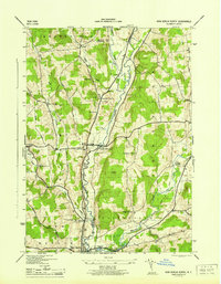
1945 Map of New Berlin North
USGS Topo · Published 1945About this map
The Unadilla River serves as the central artery for this mid-1940s landscape, marking the boundary where Chenango Co meets Otsego Co. The terrain is characterized by a high density of small rural crossroads and named family settlements like Button City, Lambs Corners, and Tallette. The agricultural and social structure of the era is evident in the numerous small burial grounds and local schoolhouses, such as Sch No 3 and School No 9, which served the outlying farmsteads between the larger hubs of South Edmeston and Pittsfield. To the south, the Hoboken Dam and the Gaging Sta on the Unadilla highlight the importance of water management in this river valley. This survey provides a look at a transitional era in central New York, before many of these small-scale community markers were consolidated or lost to modern development.
Find a feature on this map
46 named features on this map. Tap any name to fly to it.
Don’t see what you’re looking for? This feature index may not catch every label — zoom into the map to look around manually.
Map Details
Editions of this 1945 New Berlin North Map
This is the sole edition of this map. No revisions or reprints were ever made.
Other maps of this area

1907 · Winfield
USGS Topo · 1:62,500

1907 · Sangerfield
USGS Topo · 1:62,500

1910 · Hartwick
USGS Topo · 1:62,500

1910 · New Berlin
USGS Topo · 1:62,500

1912 · New Berlin
USGS Topo · 1:62,500

1912 · Hartwick
USGS Topo · 1:62,500

1943 · New Berlin North
USGS Topo · 1:24,000

1943 · New Berlin South
USGS Topo · 1:24,000

1943 · Hubbardsville
USGS Topo · 1:24,000

1943 · Unadilla Forks
USGS Topo · 1:24,000