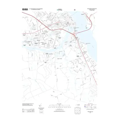
2013 Map of New Bern
USGS Topo · Published 2013About this map
The confluence of the Neuse River and the Trent River anchors this 2013 landscape, where the established neighborhoods of Trent Woods and Greenwood meet the suburban expansion of James City. The city's geography is defined by its waterfront, from the industrial and residential corridors of Bridgeton to the historic DeGraffenried Park. The Alfred A Cunningham Bridge serves as a vital artery connecting these districts, while the presence of the Coastal Carolina Regional Airport underscores the region's modern infrastructure. Further south, the map reveals a shift toward smaller communities and landing sites along Brice Cr, such as Snug Harbor and Lilliput Landing. This layout illustrates the density of settlement around the river forks, where older areas like Craven Terrace contrast with the newer residential developments of Quail Ridge and Fox Hollow.
Find a feature on this map
54 named features on this map. Tap any name to fly to it.
Don’t see what you’re looking for? This feature index may not catch every label — zoom into the map to look around manually.
Map Details
Editions of this 2013 New Bern Map
This is the sole edition of this map. No revisions or reprints were ever made.
Other maps of this area

1901 · New Bern
USGS Topo · 1:62,500

1903 · New Bern
USGS Topo · 1:62,500

1942 · Maysville
USGS Topo · 1:62,500

1948 · Maysville
USGS Topo · 1:62,500

1949 · Havelock
USGS Topo · 1:24,000

1950 · Pollocksville
USGS Topo · 1:24,000

1950 · New Bern
USGS Topo · 1:24,000

1950 · Upper Broad Creek
USGS Topo · 1:24,000

1951 · Upper Broad Creek
USGS Topo · 1:24,000

1953 · Rocky Mount
USGS Topo · 1:250,000