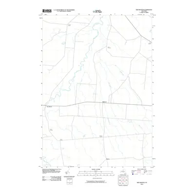
2010 Map of New Boston
USGS Topo · Published 2010About this map
Deer River and several smaller tributaries carve through this section of Lewis County, defining the rural landscape of North Country New York. The 2010 geography reveals a pattern of crossroads settlements and family-named landmarks that have persisted for generations. Hamlets like New Boston and Bellwood serve as anchors for the surrounding agricultural tracts, while numerous corners such as Pinckney Corners, Gardners Corners, and Liberty Corners mark historic intersection points of local travel and trade. Genealogists will find significant value in the documentation of several burial grounds, including Battle Cemetery, Gallup Cemetery, and Liberty Cemetery, which are preserved alongside drainage features like Cobb Creek and Silver Brook. The map illustrates the enduring placement of small communities like Rector within a network of local roads and waterways, reflecting the quiet, rural character of the Denmark region.
Find a feature on this map
14 named features on this map. Tap any name to fly to it.
Don’t see what you’re looking for? This feature index may not catch every label — zoom into the map to look around manually.
Map Details
Editions of this 2010 New Boston Map
This is the sole edition of this map. No revisions or reprints were ever made.
Other maps of this area

1895 · Watertown
USGS Topo · 1:62,500

1898 · Watertown
USGS Topo · 1:62,500

1902 · Carthage
USGS Topo · 1:62,500

1903 · Orwell
USGS Topo · 1:62,500

1904 · Carthage
USGS Topo · 1:62,500

1905 · Orwell
USGS Topo · 1:62,500

1906 · Highmarket
USGS Topo · 1:62,500

1908 · Watertown
USGS Topo · 1:62,500

1909 · Watertown
USGS Topo · 1:62,500

1942 · Copenhagen
USGS Topo · 1:24,000