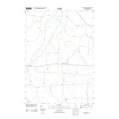
2013 Map of New Boston
USGS Topo · Published 2013About this map
The hamlets of New Boston and Bellwood anchor this rural landscape in Lewis County, where a network of grid-style roads connects historic crossroads. This 2013 survey reveals a pattern of dispersed settlements like Pinckney Corners and Gardners Corners, which persist as focal points for the surrounding agricultural tracts. The geography is defined by the winding course of the Deer River and several smaller tributaries including Mud Cr and Silver Brook. Local history and genealogy interest is concentrated near the Battle Cem and Liberty Cem, which sit alongside established routes such as Co Rte 194 and Sears Pond Rd. The presence of Rector in the south illustrates the enduring legacy of small, family-centered communities that have long characterized this part of upstate New York.
Find a feature on this map
48 named features on this map. Tap any name to fly to it.
Don’t see what you’re looking for? This feature index may not catch every label — zoom into the map to look around manually.
Map Details
Editions of this 2013 New Boston Map
This is the sole edition of this map. No revisions or reprints were ever made.
Other maps of this area

1895 · Watertown
USGS Topo · 1:62,500

1898 · Watertown
USGS Topo · 1:62,500

1902 · Carthage
USGS Topo · 1:62,500

1903 · Orwell
USGS Topo · 1:62,500

1904 · Carthage
USGS Topo · 1:62,500

1905 · Orwell
USGS Topo · 1:62,500

1906 · Highmarket
USGS Topo · 1:62,500

1908 · Watertown
USGS Topo · 1:62,500

1909 · Watertown
USGS Topo · 1:62,500

1942 · Copenhagen
USGS Topo · 1:24,000