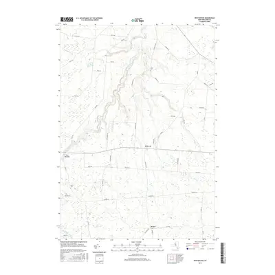
2016 Map of New Boston
USGS Topo · Published 2016About this map
Deer River meanders through the heart of this Lewis County landscape, carving a valley that anchors the local road network and small rural clusters. The area is defined by its small farming settlements, including New Boston, Bellwood, and Rector, which are connected by a grid of local thoroughfares like Marriott Rd and Gardner Rd. Historical roots are evident at Battle Cem near the intersection of Woodbattle Rd and Thesier Rd, as well as Liberty Cem located off Factory Rd. The terrain is drained by several waterways, with Mud Cr and Stony Cr branching across the eastern portion of the quadrangle. The mapping reveals a quiet agrarian character, where the placement of cemeteries and named brooks like Silver Brook reflects generations of local land use and family history in the town of Denmark.
Find a feature on this map
41 named features on this map. Tap any name to fly to it.
Don’t see what you’re looking for? This feature index may not catch every label — zoom into the map to look around manually.
Map Details
Editions of this 2016 New Boston Map
This is the sole edition of this map. No revisions or reprints were ever made.
Other maps of this area

1895 · Watertown
USGS Topo · 1:62,500

1898 · Watertown
USGS Topo · 1:62,500

1902 · Carthage
USGS Topo · 1:62,500

1903 · Orwell
USGS Topo · 1:62,500

1904 · Carthage
USGS Topo · 1:62,500

1905 · Orwell
USGS Topo · 1:62,500

1906 · Highmarket
USGS Topo · 1:62,500

1908 · Watertown
USGS Topo · 1:62,500

1909 · Watertown
USGS Topo · 1:62,500

1942 · Copenhagen
USGS Topo · 1:24,000