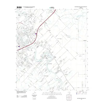
2013 Map of New Braunfels East
USGS Topo · Published 2013About this map
The Guadalupe River carves a serpentine path through this section of Comal County, anchoring a landscape where historic Texas settlements meet modern development. The Gruene Historic District stands as a focal point near Gruene Siding, reflecting the area's deep roots in the cotton and rail era. Moving downstream, the river widens into Lake Dunlap, a prominent feature that defines the local geography alongside smaller communities like Freiheit, Schumannsville, and Clear Springs. Several significant burial grounds, including Saint Peter and Paul Cem and Guadalupe Valley Memorial Park, provide essential records for genealogical research. The transition from the alluvial plains of Alligator Cr to the structured runways of the New Braunfels Municipal Airport illustrates the shift from agricultural dominance to regional transportation hub.
Find a feature on this map
260 named features on this map. Tap any name to fly to it.
Don’t see what you’re looking for? This feature index may not catch every label — zoom into the map to look around manually.
Map Details
Editions of this 2013 New Braunfels East Map
This is the sole edition of this map. No revisions or reprints were ever made.
Other maps of this area

1911 · San Marcos
USGS Topo · 1:125,000

1919 · San Marcos
USGS Topo · 1:125,000

1924 · New Braunfels No 4
USGS Topo · 1:48,000

1924 · San Marcos 3-c
USGS Topo · 1:48,000

1925 · New Braunfels No 1
USGS Topo · 1:48,000

1925 · Hunter No 3
USGS Topo · 1:48,000

1927 · New Braunfels
USGS Topo · 1:62,500

1929 · Hunter
USGS Topo · 1:62,500

1930 · Seguin
USGS Topo · 1:62,500

1953 · Seguin
USGS Topo · 1:250,000