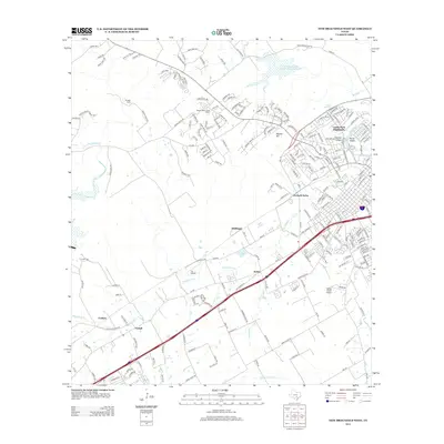
2013 Map of New Braunfels West
USGS Topo · Published 2013About this map
Solms and Dittlinger anchor the industrial and transit corridor in this 2013 look at the western reaches of the New Braunfels area. The landscape shows a distinct shift from the dense suburban development of Landa Park Highlands and Jentsch Acres to the expansive ranching properties and hills to the west. Significant water features like the Comal Springs and the winding course of Dry Comal Creek define the local topography, alongside the prominent Panther Canyon. Aviation history is present through private facilities like Fox Airport and Hilltop Ranch Airport, while historical settlements like Corbyn and Comal mark the southern edge of the survey. The mapping detail highlights the transition between established neighborhood growth and the rural heritage of Krueger Ranch and the Mission Valley Guest Ranch.
Find a feature on this map
220 named features on this map. Tap any name to fly to it.
Don’t see what you’re looking for? This feature index may not catch every label — zoom into the map to look around manually.
Map Details
Editions of this 2013 New Braunfels West Map
This is the sole edition of this map. No revisions or reprints were ever made.
Other maps of this area

1920 · Smithsons Valley
USGS Topo · 1:62,500

1924 · New Braunfels No 4
USGS Topo · 1:48,000

1925 · New Braunfels No 1
USGS Topo · 1:48,000

1925 · Hunter No 3
USGS Topo · 1:48,000

1927 · New Braunfels
USGS Topo · 1:62,500

1927 · Smithson Valley
USGS Topo · 1:62,500

1929 · Hunter
USGS Topo · 1:62,500

1929 · Smithson Valley
USGS Topo · 1:62,500

1940 · Smithson Valley
USGS Topo · 1:62,500

1953 · Schertz
USGS Topo · 1:24,000