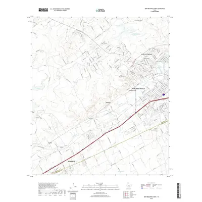
2019 Map of New Braunfels West
USGS Topo · Published 2019About this map
Comal Springs feeds the Comal River in the heart of New Braunfels, a landscape shaped by the Balcones Fault where the Texas Hill Country meets the Blackland Prairie. This 2019 survey captures the modern residential expansion of Landa Park Highlands and Jentsch Acres against the historic natural landmarks of Panther Canyon and Mission Hill. To the southwest, the corridor of Interstate 35 connects the city to Schertz, passing through the older rail-side locales of Dittlinger and Comal. The map details a complex intersection of suburban development and aviation, featuring both Fox Airport and the Hilltop Ranch Airport. Relief features like Keller Ridge and Krueger Canyon dominate the northwestern quadrant, while the seasonal drainage of Dry Comal Cr and Fourmile Cr weave through the transitioning ranch lands.
Find a feature on this map
195 named features on this map. Tap any name to fly to it.
Don’t see what you’re looking for? This feature index may not catch every label — zoom into the map to look around manually.
Map Details
Editions of this 2019 New Braunfels West Map
This is the sole edition of this map. No revisions or reprints were ever made.
Other maps of this area

1920 · Smithsons Valley
USGS Topo · 1:62,500

1924 · New Braunfels No 4
USGS Topo · 1:48,000

1925 · New Braunfels No 1
USGS Topo · 1:48,000

1925 · Hunter No 3
USGS Topo · 1:48,000

1927 · New Braunfels
USGS Topo · 1:62,500

1927 · Smithson Valley
USGS Topo · 1:62,500

1929 · Hunter
USGS Topo · 1:62,500

1929 · Smithson Valley
USGS Topo · 1:62,500

1940 · Smithson Valley
USGS Topo · 1:62,500

1953 · Schertz
USGS Topo · 1:24,000