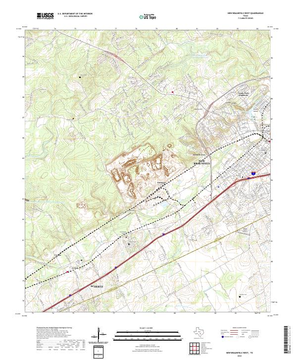
2022 Map of New Braunfels West
USGS Topo · Published 2022About this map
New Braunfels and the northern reaches of Schertz anchor this Texas landscape, where the Balcones Escarpment's influence is evident in the transition from the developed Edwards Plateau edge to the rolling plains. The hydrology of the region is centered on the significant Comal Springs and the winding course of Dry Comal Cr, alongside conservation efforts visible at the Soil Conservation Service Site 3 Reservoir.
Find a feature on this map
213 named features on this map. Tap any name to fly to it.
Don’t see what you’re looking for? This feature index may not catch every label — zoom into the map to look around manually.
Map Details
Editions of this 2022 New Braunfels West Map
This is the sole edition of this map. No revisions or reprints were ever made.
Other maps of this area

1920 · Smithsons Valley
USGS Topo · 1:62,500

1924 · New Braunfels No 4
USGS Topo · 1:48,000

1925 · New Braunfels No 1
USGS Topo · 1:48,000

1925 · Hunter No 3
USGS Topo · 1:48,000

1927 · New Braunfels
USGS Topo · 1:62,500

1927 · Smithson Valley
USGS Topo · 1:62,500

1929 · Hunter
USGS Topo · 1:62,500

1929 · Smithson Valley
USGS Topo · 1:62,500

1940 · Smithson Valley
USGS Topo · 1:62,500

1953 · Schertz
USGS Topo · 1:24,000