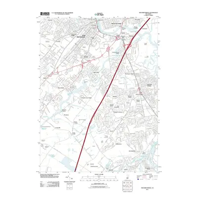
2011 Map of New Brunswick
USGS Topo · Published 2011About this map
New Brunswick and the surrounding Middlesex County landscape are defined by the convergence of the Raritan River and its intricate network of tributaries. This modern survey illustrates the suburban expansion of communities such as Highland Park, Milltown, and South River, where industrial history meets academic institutional growth. The sprawling campus of Rutgers University New Brunswick anchors the northern portion of the sheet, while the southern reaches transition into a landscape heavily populated by large memorial parks and cemeteries, including Beth Abraham Cemetery and the expansive Holy Cross Burial Park.
Find a feature on this map
90 named features on this map. Tap any name to fly to it.
Don’t see what you’re looking for? This feature index may not catch every label — zoom into the map to look around manually.
Map Details
Editions of this 2011 New Brunswick Map
This is the sole edition of this map. No revisions or reprints were ever made.
Other maps of this area

1888 · Plainfield
USGS Topo · 1:62,500

1888 · New Brunswick
USGS Topo · 1:62,500

1888 · Princeton
USGS Topo · 1:62,500

1891 · Somerville
USGS Topo · 1:62,500

1893 · New Brunswick
USGS Topo · 1:62,500

1893 · Plainfield
USGS Topo · 1:62,500

1893 · Somerville
USGS Topo · 1:62,500

1894 · Princeton
USGS Topo · 1:62,500

1898 · Plainfield
USGS Topo · 1:62,500

1898 · Somerville
USGS Topo · 1:62,500