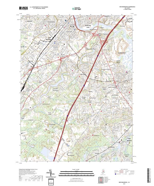
2023 Map of New Brunswick
USGS Topo · Published 2023About this map
New Brunswick and its surrounding suburban centers appear here in great detail, showcasing a landscape defined by its historic waterways and sprawling burial grounds. The Raritan River and the Delaware and Raritan Canal cut through the northern portion of the map, serving as the traditional industrial and transportation spine for Highland Park and East Franklin. To the south, the terrain shifts into a complex of residential developments like Lawrence Brook Manor and Fairview Knolls, interspersed with significant ecological features such as Pigeon Swamp and the Great Ditch. This area is particularly notable for its high density of cemeteries, including the extensive Holy Cross Burial Park and Mausoleum and the historic Willow Grove Cem, which provide essential points of interest for genealogical research. The mapping reveals how modern infrastructure, such as the Amtrak / NJ Transit rail lines and various state routes, integrates with established neighborhoods like Milltown and Helmetta.
Find a feature on this map
92 named features on this map. Tap any name to fly to it.
Don’t see what you’re looking for? This feature index may not catch every label — zoom into the map to look around manually.
Map Details
Editions of this 2023 New Brunswick Map
This is the sole edition of this map. No revisions or reprints were ever made.
Other maps of this area

1888 · Plainfield
USGS Topo · 1:62,500

1888 · New Brunswick
USGS Topo · 1:62,500

1888 · Princeton
USGS Topo · 1:62,500

1891 · Somerville
USGS Topo · 1:62,500

1893 · New Brunswick
USGS Topo · 1:62,500

1893 · Plainfield
USGS Topo · 1:62,500

1893 · Somerville
USGS Topo · 1:62,500

1894 · Princeton
USGS Topo · 1:62,500

1898 · Plainfield
USGS Topo · 1:62,500

1898 · Somerville
USGS Topo · 1:62,500