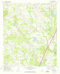
1971 Map of New Byram
USGS Topo · Published 1973About this map
New Byram and its surrounding rural communities in Hinds County appear here during a period of transition in the early 1970s. The landscape is defined by the Pearl River at Wansley Bend, where the county line meets Rankin County. The transportation network is anchored by the Illinois Central Gulf railroad, which runs parallel to the river valley. The map reveals a high density of rural religious and community centers, such as Mt Salem Ch, Rhodes Creek Ch, and New Haven Ch, suggesting a deeply rooted social geography. In the northwest, the Raymond Lookout Tower and Seven Springs overlook a terrain marked by Gravel Pits, while smaller settlements like Bethesda and Pine Grove sit further south. This survey captures the area before the significant suburban expansion that would later alter these small Mississippi crossroads.
Find a feature on this map
42 named features on this map. Tap any name to fly to it.
Don’t see what you’re looking for? This feature index may not catch every label — zoom into the map to look around manually.
Map Details
Editions of this 1971 New Byram Map
This is the sole edition of this map. No revisions or reprints were ever made.
Other maps of this area

1903 · Jackson
USGS Topo · 1:125,000

1905 · Jackson
USGS Topo · 1:48,000

1906 · Florence
USGS Topo · 1:62,500

1908 · Jackson
USGS Topo · 1:62,500

1908 · Florence
USGS Topo · 1:62,500

1934 · Raymond
USGS Topo · 1:48,000

1937 · Raymond
USGS Topo · 1:62,500

1937 · Terry
USGS Topo · 1:48,000

1942 · Raymond
USGS Topo · 1:62,500

1943 · Terry
USGS Topo · 1:62,500