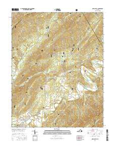
2016 Map of New Castle
USGS Topo · Published 2016About this map
New Castle serves as a focal point at the confluence of Johns Creek and Craig Creek, where the valley floor meets the steep ascent of the surrounding ridges. The landscape is defined by the expansive Jefferson National Forest and George Washington National Forest, which cover much of the high ground including Potts Mountain and Bald Mtn. Smaller settlements and historic localities like Virginia Mineral Springs and Marshalltown are tucked into the Craig Creek Valley, linked by a network of winding roads such as State Rte 615 and State Rte 614. The map illustrates a classic Appalachian drainage pattern, with numerous tributaries like Barbours Cr, Lipes Br, and Dry Br feeding the larger creek systems. This 2016 survey documents the enduring rural character and topography of Craig County, showing the intersection of managed forest lands and narrow agricultural valleys.
Find a feature on this map
47 named features on this map. Tap any name to fly to it.
Don’t see what you’re looking for? This feature index may not catch every label — zoom into the map to look around manually.
Map Details
Editions of this 2016 New Castle Map
This is the sole edition of this map. No revisions or reprints were ever made.
Other maps of this area

1887 · Lewisburg
USGS Topo · 1:125,000

1890 · Roanoke
USGS Topo · 1:125,000

1890 · Christiansburg
USGS Topo · 1:125,000

1891 · Roanoke
USGS Topo · 1:125,000

1891 · Lewisburg
USGS Topo · 1:125,000

1894 · Natural Bridge
USGS Topo · 1:125,000

1913 · Eagle Rock
USGS Topo · 1:48,000

1915 · Eagle Rock
USGS Topo · 1:62,500

1929 · Roanoke
USGS Topo · 1:48,000

1929 · Salem
USGS Topo · 1:48,000