
Loading...
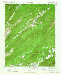
Loading map...2022 Map of New Castle
USGS Topo · Published 2022About this map
New Castle serves as the focal point of this Craig County landscape, home to the Craig County Courthouse and several local family burying grounds including the Waugh Family Cem and Greenway Family Cem. The terrain is defined by the significant mountain ridges of Potts Mountain and Broad Run Mtn, which frame the agricultural and residential corridors of Craig Creek Valley.
Find a feature on this map
70 named features on this map. Tap any name to fly to it.
Don’t see what you’re looking for? This feature index may not catch every label — zoom into the map to look around manually.
Map Details
Date Portrayed2022
Date Published2022
PublisherU.S. Geological Survey
Map TypeTopographic
Scale1:24,000
Physical Dimensions24 x 29 inches
Editions of this 2022 New Castle Map
This is the sole edition of this map. No revisions or reprints were ever made.
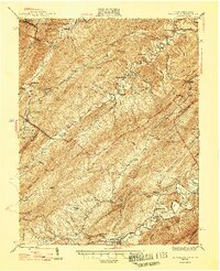
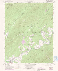
Historical Maps of New Castle Through Time
4 maps found
Featured Locations
Source Details
SourceU.S. Geological Survey
CopyrightPublic Domain