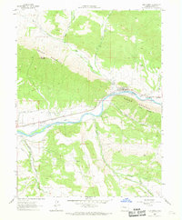
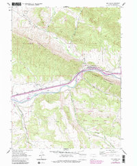
1962 Map of New Castle
USGS Topo · Published 1969About this map
The Colorado River corridor dominates this 1960s landscape, where the town of New Castle sits at the foot of the Grand Hogback. This geological feature creates a sharp divide in the terrain, separating the high plateaus from the river valley below. The presence of Burning Mountain and Coal Ridge reflects the area's subterranean geology and mining history, while the Denver and Rio Grande Western railroad tracks follow the river's path, underlining the importance of the rail-and-river transport network.
Find a feature on this map
23 named features on this map. Tap any name to fly to it.
Don’t see what you’re looking for? This feature index may not catch every label — zoom into the map to look around manually.
Map Details
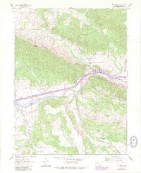
Editions of this 1962 New Castle Map
7 editions found
Other maps of this area

1906 · Grand Hogback
USGS Topo · 1:125,000

1910 · Grand Hogback
USGS Topo · 1:125,000

1927 · Glenwood Springs
USGS Topo · 1:125,000

1930 · Glenwood Springs
USGS Topo · 1:125,000

1957 · Leadville
USGS Topo · 1:250,000

1959 · Leadville
USGS Topo · 1:250,000

1960 · Leadville
USGS Topo · 1:250,000

1962 · Leadville
USGS Topo · 1:250,000

1962 · New Castle
USGS Topo · 1:24,000

1962 · Storm King Mountain
USGS Topo · 1:24,000