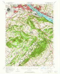
1956 Map of New Cumberland
USGS Topo · Published 1965About this map
The Susquehanna River serves as the dominant artery of this mid-century Pennsylvania landscape, separating the bustling capital at Harrisburg from its expanding west shore suburbs. Significant military and industrial infrastructure lines the riverbanks, notably the US Mil Res New Cumberland General Depot and the Harrisburg State Airport. The transportation network is defined by the heavy rail lines of the Pennsylvania Railroad and the sweep of the Pennsylvania Turnpike, which cuts through the heart of the Cumberland and York county borderlands.
Find a feature on this map
140 named features on this map. Tap any name to fly to it.
Don’t see what you’re looking for? This feature index may not catch every label — zoom into the map to look around manually.
Map Details
Editions of this 1956 New Cumberland Map
Other maps of this area

1892 · Hummelstown
USGS Topo · 1:62,500

1892 · Harrisburg
USGS Topo · 1:62,500

1899 · Harrisburg
USGS Topo · 1:62,500

1904 · Carlisle
USGS Topo · 1:62,500

1906 · New Cumberland
USGS Topo · 1:62,500

1907 · New Bloomfield
USGS Topo · 1:62,500

1908 · Middletown
USGS Topo · 1:62,500

1908 · Gettysburg
USGS Topo · 1:62,500

1908 · York
USGS Topo · 1:62,500

1910 · York
USGS Topo · 1:62,500