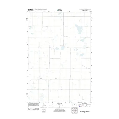
2011 Map of New Effington NW
USGS Topo · Published 2011About this map
Bohemian Cemetery and Thompson Cemetery anchor the southern landscape of this prairie terrain along the border of North and South Dakota. The survey reveals a region defined by a grid of rural section roads, including County Rd 21 and County Rd 22, which connect isolated homesteads and agricultural tracts. The most prominent natural feature is the Big Slough, a winding wetland complex that meanders through the eastern portion of the quadrangle. The placement of the cemeteries along 102nd St suggests an early focus of community life in this high-plains farming district. The landscape is characterized by numerous small, scattered wetlands and depressions typical of the glacial till plains found in the Lake Traverse District.
Find a feature on this map
26 named features on this map. Tap any name to fly to it.
Don’t see what you’re looking for? This feature index may not catch every label — zoom into the map to look around manually.
Map Details
Editions of this 2011 New Effington NW Map
This is the sole edition of this map. No revisions or reprints were ever made.
Other maps of this area

1904 · Wahpeton
USGS Topo · 1:125,000

1907 · Wyndmere
USGS Topo · 1:125,000

1917 · New Effington
USGS Topo · 1:62,500

1953 · Milbank
USGS Topo · 1:250,000

1953 · Fargo
USGS Topo · 1:250,000

1956 · Fargo
USGS Topo · 1:250,000

1958 · Milbank
USGS Topo · 1:250,000

1964 · Hankinson
USGS Topo · 1:24,000

1964 · Hankinson SE
USGS Topo · 1:24,000
1964 · Swan Lake
USGS Topo · 1:24,000