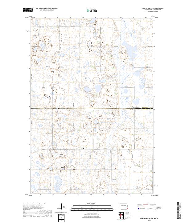
2024 Map of New Effington NW
USGS Topo · Published 2024About this map
The state line between North Dakota and South Dakota bisects this prairie landscape, where the administrative transition from Richland to Roberts county occurs amidst a dense network of small wetlands. This modern survey reveals a region dedicated to conservation and heritage, dominated by several segments of the Richland County Waterfowl Production Area and the Roberts County Waterfowl Production Area. These protected zones preserve the characteristic "pothole" topography of the region. Scattered among the section lines and rural routes like Co Rd 22 and 462nd Ave are quiet landmarks of early settlement history, including the Bohemian Cem and Thompson Cem, which serve as vital touchstones for genealogists tracing the local farming families of the northern plains.
Find a feature on this map
32 named features on this map. Tap any name to fly to it.
Don’t see what you’re looking for? This feature index may not catch every label — zoom into the map to look around manually.
Map Details
Editions of this 2024 New Effington NW Map
This is the sole edition of this map. No revisions or reprints were ever made.
Other maps of this area

1904 · Wahpeton
USGS Topo · 1:125,000

1907 · Wyndmere
USGS Topo · 1:125,000

1917 · New Effington
USGS Topo · 1:62,500

1953 · Milbank
USGS Topo · 1:250,000

1953 · Fargo
USGS Topo · 1:250,000

1956 · Fargo
USGS Topo · 1:250,000

1958 · Milbank
USGS Topo · 1:250,000

1964 · Hankinson
USGS Topo · 1:24,000

1964 · Hankinson SE
USGS Topo · 1:24,000
1964 · Swan Lake
USGS Topo · 1:24,000