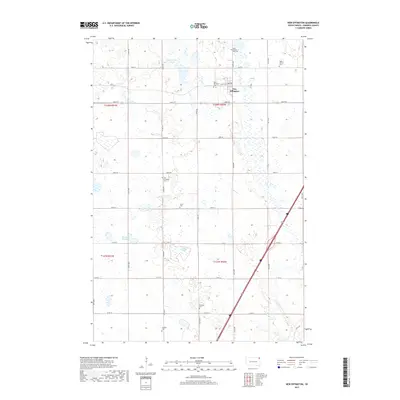
2017 Map of New Effington
USGS Topo · Published 2017About this map
New Effington serves as the focal point of this northeastern South Dakota landscape, characterized by a dense concentration of historical burial grounds and prairie sloughs. The township layout reveals a community deeply rooted in its heritage, with numerous family and congregation-linked sites such as Walla Church Cem and Zions Cem dotting the grid. Significant water bodies including Dobberstien Slough and Slather Slough define the terrain between the section-line roads, illustrating the glacial wetland topography typical of Roberts County. The presence of both the New Effington Cem and the Old Effington Cem suggests a shifting center of settlement or an evolving municipal history, while landmarks like Walla Church remain as touchstones for local genealogical research.
Find a feature on this map
35 named features on this map. Tap any name to fly to it.
Don’t see what you’re looking for? This feature index may not catch every label — zoom into the map to look around manually.
Map Details
Editions of this 2017 New Effington Map
This is the sole edition of this map. No revisions or reprints were ever made.
Other maps of this area

1916 · Peever
USGS Topo · 1:62,500

1917 · New Effington
USGS Topo · 1:62,500

1918 · Peever
USGS Topo · 1:62,500

1953 · Milbank
USGS Topo · 1:250,000

1958 · Milbank
USGS Topo · 1:250,000
1964 · Claire City NE
USGS Topo · 1:24,000

1964 · Claire City
USGS Topo · 1:24,000

1970 · Sisseton
USGS Topo · 1:24,000
1971 · Peever NW
USGS Topo · 1:24,000
1971 · Peever NE
USGS Topo · 1:24,000