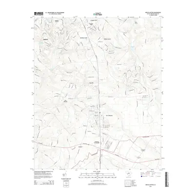
2014 Map of New Ellenton
USGS Topo · Published 2014About this map
New Ellenton and the surrounding Aiken County landscape appear here in the early 21st century, defined by a transition from established rural crossroads to residential expansion. The map detail highlights historical points of interest such as Spring Cem and Berry Cem, alongside the community of Talatha and the prominent Johnson Crossroads. This area south of Aiken shows a complex network of residential developments like College Acres and Hunters Glen interspersed with numerous water features including Halley Lake, Anderson Millpond, and Burdens Deep Pond. The southern portion of the sheet is dominated by the Savanna River site boundary, marking a significant geographic and jurisdictional divide in the region. Local hydrology is further defined by the winding paths of Hollow Cr, Dry Br, and Cedar Cr, which carve through the terrain and influence the placement of early settlements and modern road networks alike.
Find a feature on this map
162 named features on this map. Tap any name to fly to it.
Don’t see what you’re looking for? This feature index may not catch every label — zoom into the map to look around manually.
Map Details
Editions of this 2014 New Ellenton Map
This is the sole edition of this map. No revisions or reprints were ever made.
Other maps of this area

1920 · Aiken
USGS Topo · 1:48,000

1920 · Talatha
USGS Topo · 1:48,000

1921 · Augusta
USGS Topo · 1:62,500

1921 · Aiken
USGS Topo · 1:62,500

1921 · Talatha
USGS Topo · 1:62,500

1923 · Warrenville
USGS Topo · 1:48,000

1928 · Warrenville
USGS Topo · 1:62,500

1943 · Aiken
USGS Topo · 1:62,500

1943 · Augusta East
USGS Topo · 1:125,000

1943 · Warrenville
USGS Topo · 1:62,500