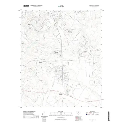
2020 Map of New Ellenton
USGS Topo · Published 2020About this map
New Ellenton and the southern outskirts of Aiken anchor this 2020 landscape, where suburban expansion meets the drainages of the Hollow Cr and Johnson Fork. The terrain is defined by a series of small water bodies and historical crossing points, including Williamson Lake and Anderson Millpond, which reflect the area's long-standing relationship with its local waterways. Residential developments like College Acres and Oak Hill are interwoven with the natural topography of Wise Hollow and the wooded banks of Cedar Cr. For genealogists and local historians, several burial sites remain preserved amidst the growing infrastructure, such as Spring Cem, Berry Cem, and Fairfield Cem. These landmarks, along with established rural junctions like Talatha and Johnson Crossroads, provide a clear view of the transition from historical agricultural roots to modern South Carolina residential communities.
Find a feature on this map
207 named features on this map. Tap any name to fly to it.
Don’t see what you’re looking for? This feature index may not catch every label — zoom into the map to look around manually.
Map Details
Editions of this 2020 New Ellenton Map
This is the sole edition of this map. No revisions or reprints were ever made.
Other maps of this area

1920 · Aiken
USGS Topo · 1:48,000

1920 · Talatha
USGS Topo · 1:48,000

1921 · Augusta
USGS Topo · 1:62,500

1921 · Aiken
USGS Topo · 1:62,500

1921 · Talatha
USGS Topo · 1:62,500

1923 · Warrenville
USGS Topo · 1:48,000

1928 · Warrenville
USGS Topo · 1:62,500

1943 · Aiken
USGS Topo · 1:62,500

1943 · Augusta East
USGS Topo · 1:125,000

1943 · Warrenville
USGS Topo · 1:62,500