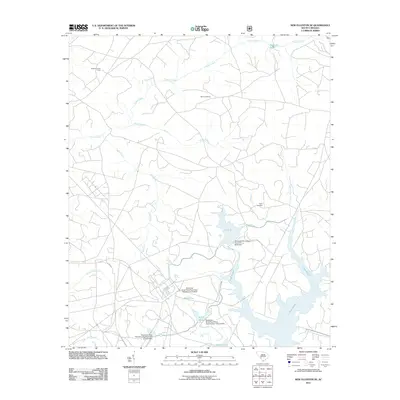
2011 Map of New Ellenton SE
USGS Topo · Published 2011About this map
Industrial water management and historic land markers define this landscape within the Savannah River Site. The expansive waters of Par Pond and Pond B dominate the southern half of the map, supported by massive infrastructure like the Savannah River Plant Pond B D-3078 Dam. This network of artificial reservoirs and dams reflects the mid-century transformation of the area for federal nuclear production, repurposing the drainage of natural streams like Tinker Creek and Lower Three Runs.
Find a feature on this map
19 named features on this map. Tap any name to fly to it.
Don’t see what you’re looking for? This feature index may not catch every label — zoom into the map to look around manually.
Map Details
Editions of this 2011 New Ellenton SE Map
This is the sole edition of this map. No revisions or reprints were ever made.
Other maps of this area

1919 · Allendale
USGS Topo · 1:62,500

1920 · Ellenton
USGS Topo · 1:48,000

1920 · Talatha
USGS Topo · 1:48,000

1921 · Talatha
USGS Topo · 1:62,500

1921 · Ellenton
USGS Topo · 1:62,500

1923 · Williston
USGS Topo · 1:48,000

1927 · Williston
USGS Topo · 1:62,500

1943 · Allendale
USGS Topo · 1:62,500

1943 · Augusta East
USGS Topo · 1:125,000

1943 · Williston
USGS Topo · 1:62,500