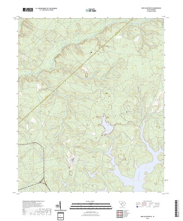
2024 Map of New Ellenton SE
USGS Topo · Published 2024About this map
Tinker Creek and the southern reaches of Lower Three Runs dominate this landscape along the border of Aiken and Barnwell counties. The area is characterized by a complex network of waterways and managed impoundments, including the significant waters of Pond B and Pond Four. While the terrain is largely defined by these hydrological features and their associated branches like Fourmile Branch and Reedy Branch, smaller markers of local history remain on the land. Genealogists and local historians will find the locations of Dorch Cem in the north and Scott Cem further south, providing specific points of interest amidst the forest and wetlands that surround Kennedys Pond and the winding course of Mill Creek.
Find a feature on this map
13 named features on this map. Tap any name to fly to it.
Don’t see what you’re looking for? This feature index may not catch every label — zoom into the map to look around manually.
Map Details
Editions of this 2024 New Ellenton SE Map
This is the sole edition of this map. No revisions or reprints were ever made.
Other maps of this area

1919 · Allendale
USGS Topo · 1:62,500

1920 · Ellenton
USGS Topo · 1:48,000

1920 · Talatha
USGS Topo · 1:48,000

1921 · Talatha
USGS Topo · 1:62,500

1921 · Ellenton
USGS Topo · 1:62,500

1923 · Williston
USGS Topo · 1:48,000

1927 · Williston
USGS Topo · 1:62,500

1943 · Allendale
USGS Topo · 1:62,500

1943 · Augusta East
USGS Topo · 1:125,000

1943 · Williston
USGS Topo · 1:62,500