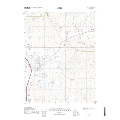
2018 Map of New Empire
USGS Topo · Published 2018About this map
The Carson River winds through this Nevada landscape at the junction of the Virginia Range and the Ten Mile Desert. The region's industrial and transport heritage is evident in the transition from the historic Empire Cem and the settlement of Empire to the modern logistics hubs like Carson Airport and Parker Carson Airport. The presence of the Mexican Ditch and the proximity to Prison Hill at the southeastern edge of Carson City highlights the development of infrastructure to support both agriculture and civil institutions in this high-desert environment. Further east, Mound House serves as a notable waypoint where several canyons, including Santiago Canyon and Brunswick Canyon, converge. This 2018 survey reveals a landscape of complex drainage systems, such as Currus Warm Springs and Badger Spring, interspersed with a growing suburban road network.
Find a feature on this map
123 named features on this map. Tap any name to fly to it.
Don’t see what you’re looking for? This feature index may not catch every label — zoom into the map to look around manually.
Map Details
Editions of this 2018 New Empire Map
This is the sole edition of this map. No revisions or reprints were ever made.
Other maps of this area

1891 · Carson
USGS Topo · 1:125,000

1893 · Carson
USGS Topo · 1:125,000

1950 · Virginia City
USGS Topo · 1:62,500

1950 · Mt. Rose
USGS Topo · 1:62,500

1952 · Mt. Rose
USGS Topo · 1:62,500

1952 · Virginia City
USGS Topo · 1:62,500

1956 · Dayton
USGS Topo · 1:62,500

1956 · Carson City
USGS Topo · 1:62,500

1957 · Reno
USGS Topo · 1:250,000

1959 · Reno
USGS Topo · 1:250,000