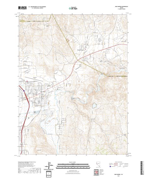
2021 Map of New Empire
USGS Topo · Published 2021About this map
The Carson River winds through the canyons and valleys of this landscape, serving as a historic corridor for settlement and industry between the Virginia Range and the foothills of Prison Hill. This high-desert terrain is characterized by the convergence of several major canyons, including Brunswick Canyon, Santiago Canyon, and Daney Canyon, which drain into the floor of Eagle Valley. The map highlights the development around New Empire and the nearby Empire Cem, reflecting the area's legacy as a processing hub for the silver mines of the Comstock Lode. Aviation history is also present through both the Carson City Airport and the Parker Carson Airport. Further east, the Ten Mile Desert and Spring Valley showcase the more arid, expansive reaches of the region near the settlement of Mound House.
Find a feature on this map
125 named features on this map. Tap any name to fly to it.
Don’t see what you’re looking for? This feature index may not catch every label — zoom into the map to look around manually.
Map Details
Editions of this 2021 New Empire Map
This is the sole edition of this map. No revisions or reprints were ever made.
Other maps of this area

1891 · Carson
USGS Topo · 1:125,000

1893 · Carson
USGS Topo · 1:125,000

1950 · Virginia City
USGS Topo · 1:62,500

1950 · Mt. Rose
USGS Topo · 1:62,500

1952 · Mt. Rose
USGS Topo · 1:62,500

1952 · Virginia City
USGS Topo · 1:62,500

1956 · Dayton
USGS Topo · 1:62,500

1956 · Carson City
USGS Topo · 1:62,500

1957 · Reno
USGS Topo · 1:250,000

1959 · Reno
USGS Topo · 1:250,000