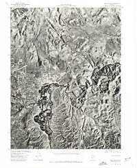
1974 Map of New Empire
USGS Topo · Published 1977About this map
Carson City and the industrial outpost of New Empire occupy the western edge of this 1974 orthophotoquad, which captures the Nevada state capital as it appeared in the mid-1970s. This specialized map uses aerial photography to show the actual footprint of residential growth spreading across Eagle Valley and the sharp contrast between the burgeoning urban center and the arid slopes of the Virginia Range to the north. The winding course of the Carson River dominates the eastern half of the sheet, cutting a path through the foothills and supporting the pockets of greenery and cultivation that define the valley floor. Unlike a standard topographic line map, this photographic record reveals the exact density of structures, the layout of the regional airport, and the specific patterns of land use during a period of significant transition for the region.
Find a feature on this map
5 named features on this map. Tap any name to fly to it.
Don’t see what you’re looking for? This feature index may not catch every label — zoom into the map to look around manually.
Map Details
Editions of this 1974 New Empire Map
This is the sole edition of this map. No revisions or reprints were ever made.
Other maps of this area

1891 · Carson
USGS Topo · 1:125,000

1893 · Carson
USGS Topo · 1:125,000

1950 · Virginia City
USGS Topo · 1:62,500

1950 · Mt. Rose
USGS Topo · 1:62,500

1952 · Mt. Rose
USGS Topo · 1:62,500

1952 · Virginia City
USGS Topo · 1:62,500

1956 · Dayton
USGS Topo · 1:62,500

1956 · Carson City
USGS Topo · 1:62,500

1957 · Reno
USGS Topo · 1:250,000

1959 · Reno
USGS Topo · 1:250,000