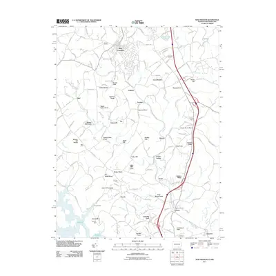
2011 Map of New Freedom
USGS Topo · Published 2011About this map
New Freedom and the surrounding borderlands of York County and northern Maryland are depicted here as the modern landscape retains the footprints of its agricultural and early industrial past. The northern reaches of Prettyboy Reservoir and the winding Gunpowder Falls define the southern terrain, while the historic corridor of the Northern Central Trl—formerly a vital rail link—cuts through the heart of the region.
Find a feature on this map
176 named features on this map. Tap any name to fly to it.
Don’t see what you’re looking for? This feature index may not catch every label — zoom into the map to look around manually.
Map Details
Editions of this 2011 New Freedom Map
This is the sole edition of this map. No revisions or reprints were ever made.
Other maps of this area

1900 · Parkton
USGS Topo · 1:62,500

1902 · Parkton
USGS Topo · 1:62,500

1905 · Westminster
USGS Topo · 1:62,500

1908 · York
USGS Topo · 1:62,500

1910 · York
USGS Topo · 1:62,500

1920 · Hanover
USGS Topo · 1:62,500

1922 · Hanover
USGS Topo · 1:62,500

1944 · New Freedom
USGS Topo · 1:31,680

1944 · Hampstead
USGS Topo · 1:31,680
1944 · Hereford
USGS Topo · 1:31,680