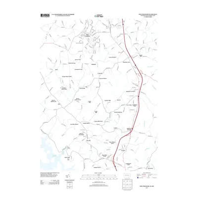
2013 Map of New Freedom
USGS Topo · Published 2013About this map
New Freedom sits at the heart of this borderland survey, where the rolling hills of southern Pennsylvania meet the Maryland state line. The landscape is defined by its deep milling history along the numerous waterways, evidenced by features such as Keeney Mill Farms, Gores Mill, and Valley Mill Farms. These labels suggest a legacy of rural industry powered by the drainages of Little Falls and Beetree Run.
Find a feature on this map
222 named features on this map. Tap any name to fly to it.
Don’t see what you’re looking for? This feature index may not catch every label — zoom into the map to look around manually.
Map Details
Editions of this 2013 New Freedom Map
This is the sole edition of this map. No revisions or reprints were ever made.
Other maps of this area

1900 · Parkton
USGS Topo · 1:62,500

1902 · Parkton
USGS Topo · 1:62,500

1905 · Westminster
USGS Topo · 1:62,500

1908 · York
USGS Topo · 1:62,500

1910 · York
USGS Topo · 1:62,500

1920 · Hanover
USGS Topo · 1:62,500

1922 · Hanover
USGS Topo · 1:62,500

1944 · New Freedom
USGS Topo · 1:31,680

1944 · Hampstead
USGS Topo · 1:31,680
1944 · Hereford
USGS Topo · 1:31,680