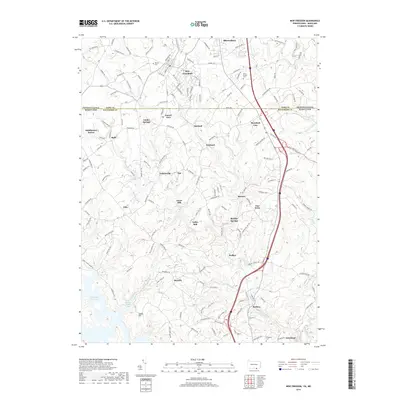
2019 Map of New Freedom
USGS Topo · Published 2019About this map
New Freedom and Shrewsbury anchor the northern reaches of this borderlands survey, where the Mason-Dixon line separates York County, Pennsylvania, from Baltimore County, Maryland. The landscape is defined by the winding course of Little Falls and its various tributaries, including Beetree Run, which cut through the undulating terrain. A legacy of early rural industry is evident in the naming of settlements like Gores Mill and Valley Mill, while the southern portion of the map transitions into the protected waters of the Prettyboy Reservoir near Spook Hill. Small, historically significant points like the Bowser Cem, Rock Chapel Cem, and Wiseburg Cem are preserved among the modern road networks. The layout of towns such as Parkton and Maryland Line illustrates the persistent importance of the north-south transportation corridor linking the two states.
Find a feature on this map
166 named features on this map. Tap any name to fly to it.
Don’t see what you’re looking for? This feature index may not catch every label — zoom into the map to look around manually.
Map Details
Editions of this 2019 New Freedom Map
This is the sole edition of this map. No revisions or reprints were ever made.
Other maps of this area

1900 · Parkton
USGS Topo · 1:62,500

1902 · Parkton
USGS Topo · 1:62,500

1905 · Westminster
USGS Topo · 1:62,500

1908 · York
USGS Topo · 1:62,500

1910 · York
USGS Topo · 1:62,500

1920 · Hanover
USGS Topo · 1:62,500

1922 · Hanover
USGS Topo · 1:62,500

1944 · New Freedom
USGS Topo · 1:31,680

1944 · Hampstead
USGS Topo · 1:31,680
1944 · Hereford
USGS Topo · 1:31,680