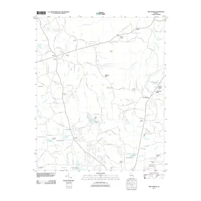
2011 Map of New Georgia
USGS Topo · Published 2011About this map
Villa Rica Mine and several other industrial sites including the Southern Klondyke Mine and Clopton Mine define the landscape north of Villa Rica, Georgia. This 2011 survey reveals an area where suburban growth meets a legacy of resource extraction, particularly near Pine Mountain and the Paulding Quarry. The map is dense with genealogical markers, from the White Oak Springs Cemetery in the north to Wesley Cemetery and the Melrose Cemetery further south. Water management is a central feature of the terrain, documented through numerous small reservoirs and infrastructure like the H L Tumlin Dam, Legion Lake Dam, and Joe Wilson Dam. Residential clusters such as Mulberry Place and Cottonwood Valley show the modern development of this region, while local landmarks like Stockmar Airport and the geological prominence of Mulberry Rock anchor the local geography.
Find a feature on this map
117 named features on this map. Tap any name to fly to it.
Don’t see what you’re looking for? This feature index may not catch every label — zoom into the map to look around manually.
Map Details
Editions of this 2011 New Georgia Map
This is the sole edition of this map. No revisions or reprints were ever made.
Other maps of this area

1889 · Tallapoosa
USGS Topo · 1:125,000

1891 · Marietta
USGS Topo · 1:125,000

1892 · Tallapoosa
USGS Topo · 1:125,000

1895 · Marietta
USGS Topo · 1:125,000

1897 · Marietta
USGS Topo · 1:125,000

1897 · Tallapoosa
USGS Topo · 1:125,000

1901 · Marietta
USGS Topo · 1:125,000

1953 · Atlanta
USGS Topo · 1:250,000

1957 · Atlanta
USGS Topo · 1:250,000

1958 · Atlanta
USGS Topo · 1:250,000