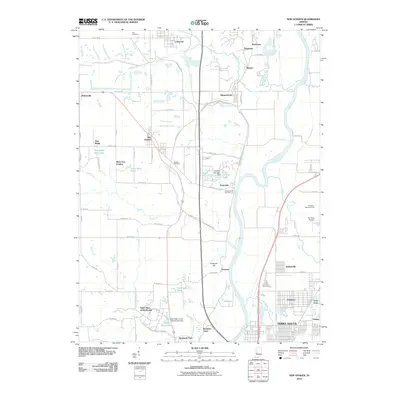
2010 Map of New Goshen
USGS Topo · Published 2010About this map
Wabash River frontage defines the eastern edge of this Vigo County landscape, where the legacy of Indiana's coal industry is etched into the terrain. Names like Pine Ridge Mine Pond and Grant Mine Pond point to the area's extraction history, while the layout of Universal and Shepardsville shows the cluster of settlements that supported these operations. To the south, the grounds of Saint Mary-of-the-Woods and Saint Marys Lake provide a distinct cultural landmark near the northern reaches of Terra Haute.
Find a feature on this map
84 named features on this map. Tap any name to fly to it.
Don’t see what you’re looking for? This feature index may not catch every label — zoom into the map to look around manually.
Map Details
Editions of this 2010 New Goshen Map
This is the sole edition of this map. No revisions or reprints were ever made.
Other maps of this area

1932 · Marshall
USGS Topo · 1:62,500

1937 · Marshall
USGS Topo · 1:62,500

1941 · Seelyville
USGS Topo · 1:24,000

1941 · Terre Haute
USGS Topo · 1:24,000

1942 · Dennison
USGS Topo · 1:24,000

1947 · Paris
USGS Topo · 1:62,500

1948 · Terre Haute
USGS Topo · 1:24,000

1949 · Paris
USGS Topo · 1:62,500

1950 · Rosedale
USGS Topo · 1:24,000

1950 · New Goshen
USGS Topo · 1:24,000