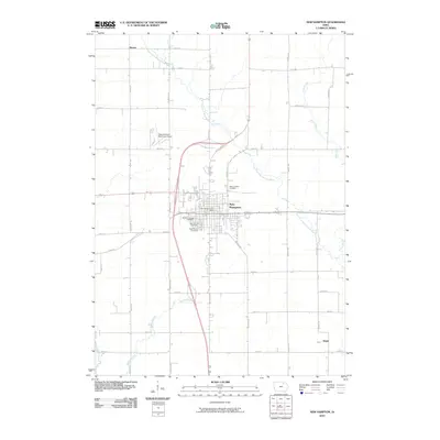
2010 Map of New Hampton
USGS Topo · Published 2010About this map
New Hampton serves as the central hub of this Chickasaw County landscape, where a dense concentration of local heritage sites clusters near the town center. The presence of four distinct burial grounds, including Saint Josephs Cemetery, Saint Marys Cemetery, and the Children of Israel Cemetery, provides significant data points for genealogical research and land-use history. The surrounding countryside is defined by the winding course of the East Fork Wapsipinicon River and its tributaries, including Spring Branch and Plum Creek.
Find a feature on this map
31 named features on this map. Tap any name to fly to it.
Don’t see what you’re looking for? This feature index may not catch every label — zoom into the map to look around manually.
Map Details
Editions of this 2010 New Hampton Map
This is the sole edition of this map. No revisions or reprints were ever made.
Other maps of this area

1954 · Mason City
USGS Topo · 1:250,000

1954 · Waterloo
USGS Topo · 1:250,000

1955 · Waterloo
USGS Topo · 1:250,000

1957 · Mason City
USGS Topo · 1:250,000

1958 · Mason City
USGS Topo · 1:250,000

1971 · Tripoli NW
USGS Topo · 1:24,000

1971 · Fredericksburg
USGS Topo · 1:24,000

1971 · Frederika
USGS Topo · 1:24,000
1972 · Ionia
USGS Topo · 1:24,000

1972 · Elma
USGS Topo · 1:24,000