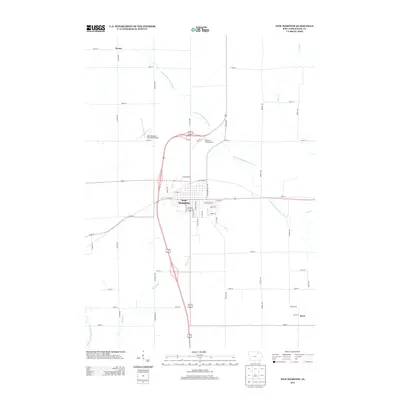
2013 Map of New Hampton
USGS Topo · Published 2013About this map
New Hampton serves as the central hub of this Chickasaw County landscape, where the municipal grid is bordered by the E Fork Wapsipinicon River to the north and east. The map documents a transition in local transportation, featuring both the New Hampton Municipal Airport and the smaller Mitchell Field Airport north of the city center. The surrounding rural areas are defined by a strict section-line road network, including Jasper Ave and Mission Ave, which connect the primary township to outlying settlements like Devon in the northwest and Boyd in the southeast. Smaller watercourses such as Spring Br and Plum Cr meander through the agricultural plots, illustrating the drainage patterns that have historically shaped land use in this part of Iowa. This 2013 survey provides a clear view of the modern infrastructure and rural layout of the region.
Find a feature on this map
46 named features on this map. Tap any name to fly to it.
Don’t see what you’re looking for? This feature index may not catch every label — zoom into the map to look around manually.
Map Details
Editions of this 2013 New Hampton Map
This is the sole edition of this map. No revisions or reprints were ever made.
Other maps of this area

1954 · Mason City
USGS Topo · 1:250,000

1954 · Waterloo
USGS Topo · 1:250,000

1955 · Waterloo
USGS Topo · 1:250,000

1957 · Mason City
USGS Topo · 1:250,000

1958 · Mason City
USGS Topo · 1:250,000

1971 · Tripoli NW
USGS Topo · 1:24,000

1971 · Fredericksburg
USGS Topo · 1:24,000

1971 · Frederika
USGS Topo · 1:24,000
1972 · Ionia
USGS Topo · 1:24,000

1972 · Elma
USGS Topo · 1:24,000